How to Find Free Camping Before the Crowds Do
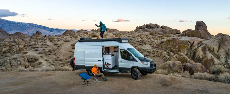
Every van lifer has been there. You pull into a spot you bookmarked three months ago, the one with the stunning mesa view and the creek access, and there are already six rigs set up. Someone's got a generator running. There's a fire ring full of beer cans. The magic is gone.
The best free camping spots in America haven't disappeared — they've just been buried under layers of social media exposure and app-driven tourism. The people consistently finding the good stuff aren't luckier than you. They're working a different system.
Here's how that system actually works.
Understand the Land Before You Search for a Spot
Most great free camping in the US happens on public land managed by the Bureau of Land Management (BLM), the US Forest Service (USFS), or state land trusts. Each of these agencies has different rules, different dispersed camping allowances, and different enforcement cultures.
BLM land is generally the most permissive. Across much of the West — Nevada, Utah, Colorado, New Mexico, Arizona, Wyoming — you can camp dispersed (meaning outside of designated campgrounds) for up to 14 consecutive days in most areas before you're required to move. After that, you typically need to relocate at least 25 miles away.
National Forests operate similarly but vary more by specific forest. Some allow dispersed camping freely; others require you to stay in designated sites. Always check the specific forest's website, not just the general USFS rules.
State trust lands are the wild card. In states like Arizona and Montana, state trust land can be gold — less trafficked than BLM, beautiful terrain, and accessible with a low-cost annual permit. Most people skip it entirely because it requires a small amount of research.
The Tools Worth Actually Using
There are a lot of apps competing for your attention. A few of them are genuinely useful.
Gaia GPS is the most serious mapping tool available for dispersed camping research. It overlays land ownership data directly onto topographic maps, letting you see exactly where BLM, USFS, and private land boundaries fall. You can download offline maps for areas with no cell service. It costs money, and it's worth it.
CalTopo is a browser-based alternative that many experienced overlanders prefer for pre-trip planning. The land management layers are excellent, and you can export routes to your phone.
iOverlander is community-sourced and skews toward the overlanding crowd rather than the Instagram van life crowd. The spots listed tend to be more remote, better vetted, and less likely to be overwhelmed.
The Dyrt and FreeRoam both have free camping databases, and they're useful — but their most popular spots get hammered. Use them to identify a region, not a specific site.
Here's the move most people miss: use these apps to find a general area that looks promising, then use Gaia or CalTopo to zoom in and find your own specific spot within that area. The app gets you to the neighborhood. You find the house.
How to Evaluate a Spot Remotely
Before you drive two hours down a dirt road, do your homework from the cab.
Google Earth's timeline feature lets you look at satellite imagery from different seasons and years. You can spot evidence of heavy use (worn-down fire rings, multiple track marks), flooding history, and whether a road is actually passable in your rig.
USGS topographic data tells you about slope, water drainage, and elevation. A spot that looks flat on a regular map might be a drainage basin that floods in spring. Know what season you're arriving in and plan accordingly.
For road conditions, the USFS and BLM both maintain road databases — though they're not always current. Supplement with recent posts in regional van life or overlanding Facebook groups, which are often more up-to-date than any official source.
Timing Is the Real Competitive Advantage
The best free spots don't get crowded because they're secret. They get crowded because of timing. Most people are traveling on the same schedule — weekends, holidays, school breaks, and the peak summer window between June and August.
If you have schedule flexibility (which is kind of the point of van life), use it. Monday through Thursday in shoulder season — April/May and September/October — is when you'll have the West largely to yourself. The light is better for photos anyway.
Also pay attention to the weather cycle. A stretch of storms in a popular area will clear out campers fast. Rolling in the day after rain clears — when roads are passable but the crowds haven't returned — is one of the most reliable ways to land a great spot.
Sustainability and Ethics Are Part of the Strategy
This isn't just a values thing — it's practical. The reason great spots get closed is because people treat them badly. When a BLM field office starts seeing trash, fire damage, and human waste at a dispersed site, they have the authority to designate it as off-limits or require fee-based permits.
Leave No Trace principles aren't optional courtesy. They're how free camping stays free.
Pack out everything. Camp on durable surfaces — rock, gravel, dry grass — not on cryptobiotic soil crusts in the desert Southwest (those dark, lumpy soil formations take decades to recover from a single footstep). Keep fires small and legal, and check burn restrictions before you light anything. Use a WAG bag or cat hole system for waste, and stay at least 200 feet from water sources.
The van life community has a real stewardship responsibility here. The more people who treat public land well, the longer the freedom to roam it stays intact.
One Last Tip
Stop sharing your best spots publicly. It sounds selfish, but it's not — it's conservation. If a spot is special to you, share it privately with people you trust, not in a public forum where it'll be visited by hundreds of strangers before the month is out.
The best camping intel still travels the old-fashioned way: from one road-worn van lifer to another, over a campfire, with a handshake agreement to treat it right.